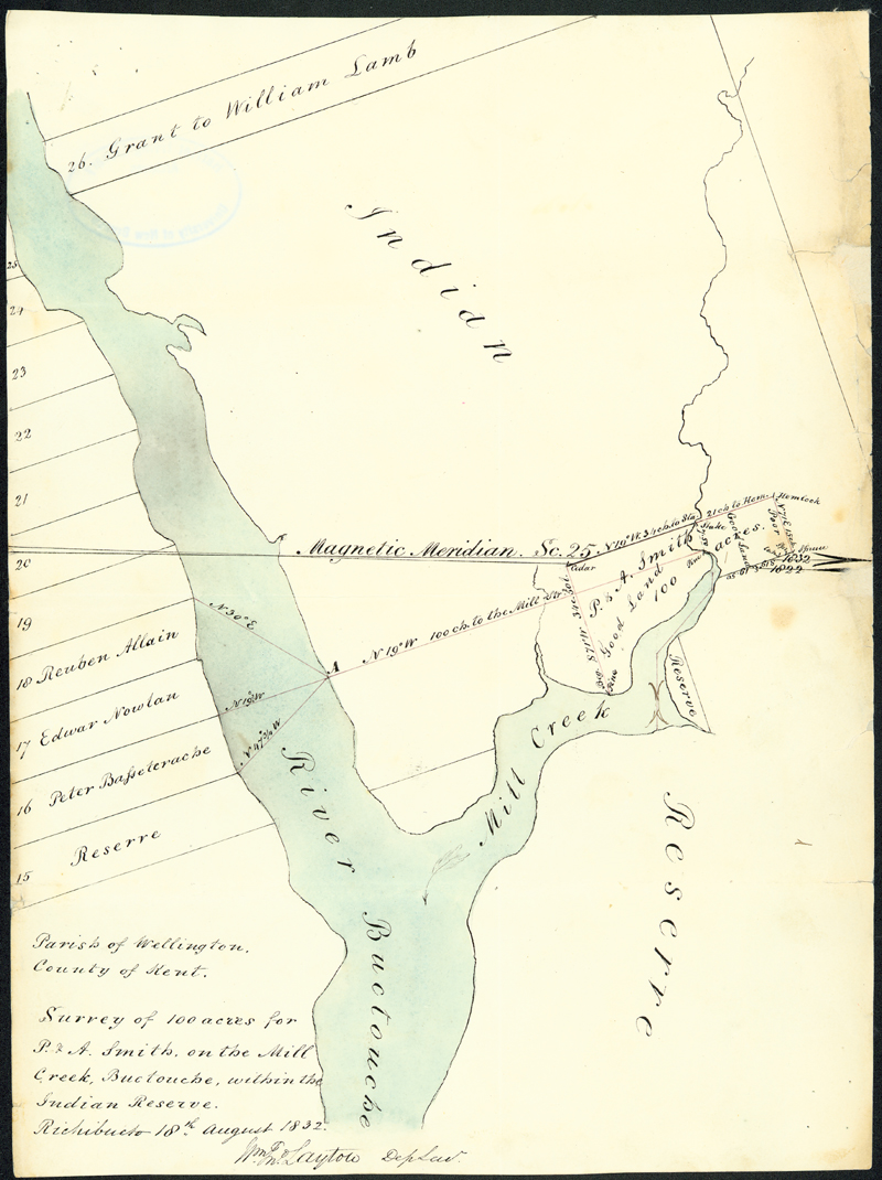
Map of the Parish of Wellington in Kent County
Gallery:
Image Gallery Map of the Parish of Wellington in Kent County
William Layton, Deputy Surveyor
18 August 1832
UNB Archives & Special Collections. Indian Affairs Documents, MG H54.
University of New Brunswick, Fredericton, New Brunswick
Maps served many purposes in nineteenth-century New Brunswick. They indicated directions to lost travellers, they served as the basis for governmental tax rolls, and they also acted as documents of imperialism by promoting, assisting, and legitimatizing the projection of European power. This map, part of a survey of 100 acres completed for Peter and Albert Smith on Mill Creek in Buctouche, acted as an essential part in physically dividing Aboriginal land into measured lots, allowing European settlers access to the land.